Due to the risk involved in bicyclist and logging operations we are going to
close the trials marked in RED on this map. Additionally,
the winter parking area or that area next to range 17 will be utilized for all bike trail
parking and access to the trails until further notice.
Please provide widest
dissemination to ensure safety of all personnel. In summation, There should
be absolutely no foot or bike traffic around those trails marked in red on
the attached map or the current trail-head. The loggers are using it as the
main route for skidding and logging
CARP Bike Trail Closings
These trails will be closed when logging is occurring:
Five Mile Loop
FreeWay (Past Pipeline)
Dogwood (South of Merlin’s Trail)
Ten Bridges
Yucca
Christmas Tree and Extension
Center Road/Helter Skelter (South of Porta Potty) (Also may be used as a logging road for 2.0 acre clearcut, 6.7 acre thinning, and 7.9 acre thinning) Outer Loop (South of Porta Potty)
Individual trails will be reopened when logging is finished in any particular area!
CARP Bike Trails that will not closed at all
Entrance Trail
Pipeline (May be used as a logging road) Zig Zag Trail Double Dip Merlin's Trail Can of Corn Dead Elvis Flatlands Loop Elevator Trail Advanced Trig Ball of Nails Love Trail Buddha Porta Potty Airport
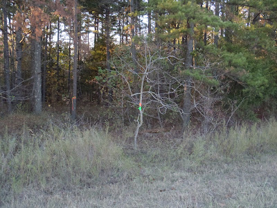
No excess puntuation in there, but the message is clear. We are being asked to park at the old Winter Parking area, which provides easy access to Airport Loop near its junction with Buddha. You've likely noticed the Winter Parking sign from the trail. The simplest directions that I can give are to enter Camp as usual, but as you approach the Aviation Support Facility (large sign on the corner, fence starts), turn right. Follow this road (note the 10MPH flashing speed limit sign as a landmark) to Cato Road (Large sign on left), turn left. Go 1.2 miles. The winter parking area is just past a stretch of fence marking the end of the runway and across from Range 17. The trailhead is down the road another 75 yards or so and is marked with tape.
The "Winter Parking" trailhead as seen from Cato Road. It intersects Airport Loop about 50 yards in.
The trail is clearly marked at the point where it meets Airport Loop.
That's it. Please stay out of the harvest area. The current arrangements will remain in place until the timber harvest is complete or until the policy changes. The folks at Camp could easily have just closed the trails, so I appreciate the fact that they're working with the bike community, though communications could have come earlier.


No comments:
Post a Comment